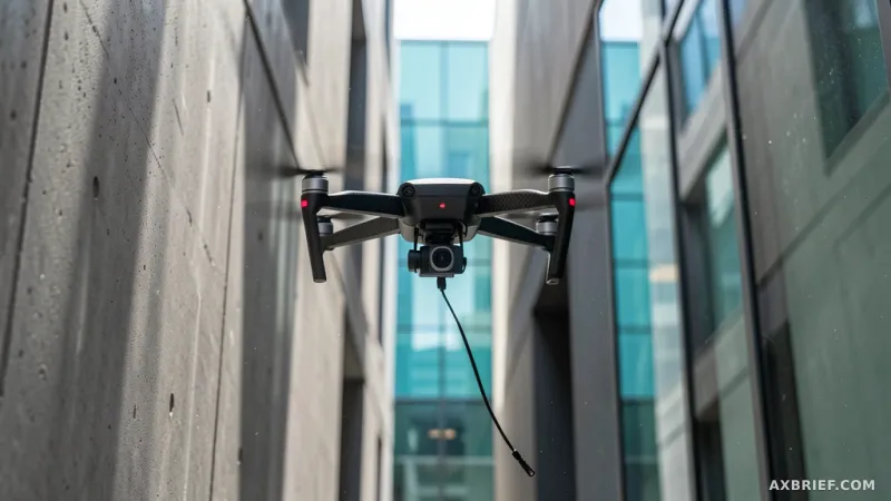
A drone navigates the jagged interior of a building collapsed by an earthquake. Every millisecond counts. To find survivors, the aircraft must weave through unstable concrete and hanging wires, adjusting its trajectory instantly as new obstacles appear in its field of vision. This is the high-stakes reality of autonomous flight in unstructured environments, where the difference between a successful mission and a catastrophic crash depends on the robot's ability to solve complex geometric puzzles in real time.
The Cost of Autonomous Precision
Researchers from MIT and the University of Pennsylvania have addressed this challenge by developing MIGHTY, a trajectory planning system designed for unmanned aerial vehicles (UAVs) operating in hazardous or complex urban settings. Their findings, published in IEEE Robotics and Automation Letters, target a critical gap in the robotics market. For years, the industry has been split between two extremes: prohibitively expensive commercial software packages that cost hundreds of thousands of dollars and open-source alternatives that often lack the performance or usability required for high-speed, real-world deployment.
MIGHTY functions as an open-source framework that allows drones to optimize both their flight path and their travel time within a single computational step. Unlike many existing systems that rely on a constant tether to a powerful external base station, MIGHTY operates entirely on the drone's onboard computer and sensors. This autonomy ensures that the UAV can maintain stable flight and execute precise maneuvers even in communication-dead zones, such as deep urban canyons or the interior of industrial ruins, where signal latency would otherwise render a remote-controlled trajectory impossible.
Breaking the Sequential Bottleneck
To understand why MIGHTY represents a shift in drone intelligence, one must look at how traditional trajectory planners operate. Most open-source systems follow a sequential logic: they first estimate the total time required to reach a destination and then attempt to find the most efficient path that fits within that fixed time window. This creates a dangerous tension. If a drone encounters an unexpected obstacle and must deviate from its path, the route becomes longer. Because the time budget is fixed, the drone is forced to accelerate aggressively to meet the deadline, often exceeding its physical limits or sacrificing stability.
MIGHTY resolves this by treating space and time as a single, integrated variable. The system employs Hermite splines—a mathematical interpolation method that connects points with smooth curves—to optimize the geometric shape of the path and the timing of the movement simultaneously. By doing so, the drone maintains a fluid trajectory where velocity and acceleration remain within safe, physically controllable limits. The result is a flight path that is not only smoother but fundamentally more efficient, as the drone no longer fights against an arbitrary time constraint.
However, integrating space and time into one optimization problem typically triggers a massive spike in computational demand, which would normally freeze an onboard processor. MIGHTY bypasses this through an initial guess technique. Instead of calculating a perfect path from scratch every few milliseconds, the system generates a rough approximation and then iteratively refines it. This iterative process is fed by real-time data from the UAV's onboard Lidar sensors. As the Lidar maps the environment, MIGHTY adjusts the initial guess to dodge obstacles in milliseconds, ensuring the drone can react to a sudden wall or a pedestrian without pausing to recalculate its entire mission profile.
In simulation trials, MIGHTY demonstrated a significant efficiency gain, operating with only 90% of the computation time required by current state-of-the-art (SOTA) methods while reaching destinations approximately 15% faster. Real-world flight tests validated these numbers, with the system successfully guiding drones at high speeds of 6.7m/s through obstacle-dense environments. By proving that high-performance control is possible using only onboard hardware and open-source logic, the researchers have effectively removed the financial barrier to entry for advanced autonomous flight.
This democratization of trajectory planning opens the door for a new wave of practical Physical AI applications. From last-mile delivery drones navigating power lines and pedestrians to industrial robots performing precision inspections of wind turbines, the ability to fly fast and safe without a six-figure software license changes the economics of autonomous robotics.